
ARCHIVE ENTRY: [JA-IW-001] (Ref: ARCHIVE: CV-001 / LOG-SHEAR-60S // CODEWORD: COLLISION VECTOR)
CLASSIFICATION: Level 5 Secure // Syndicate Polar Geophysics Core (Declassified)
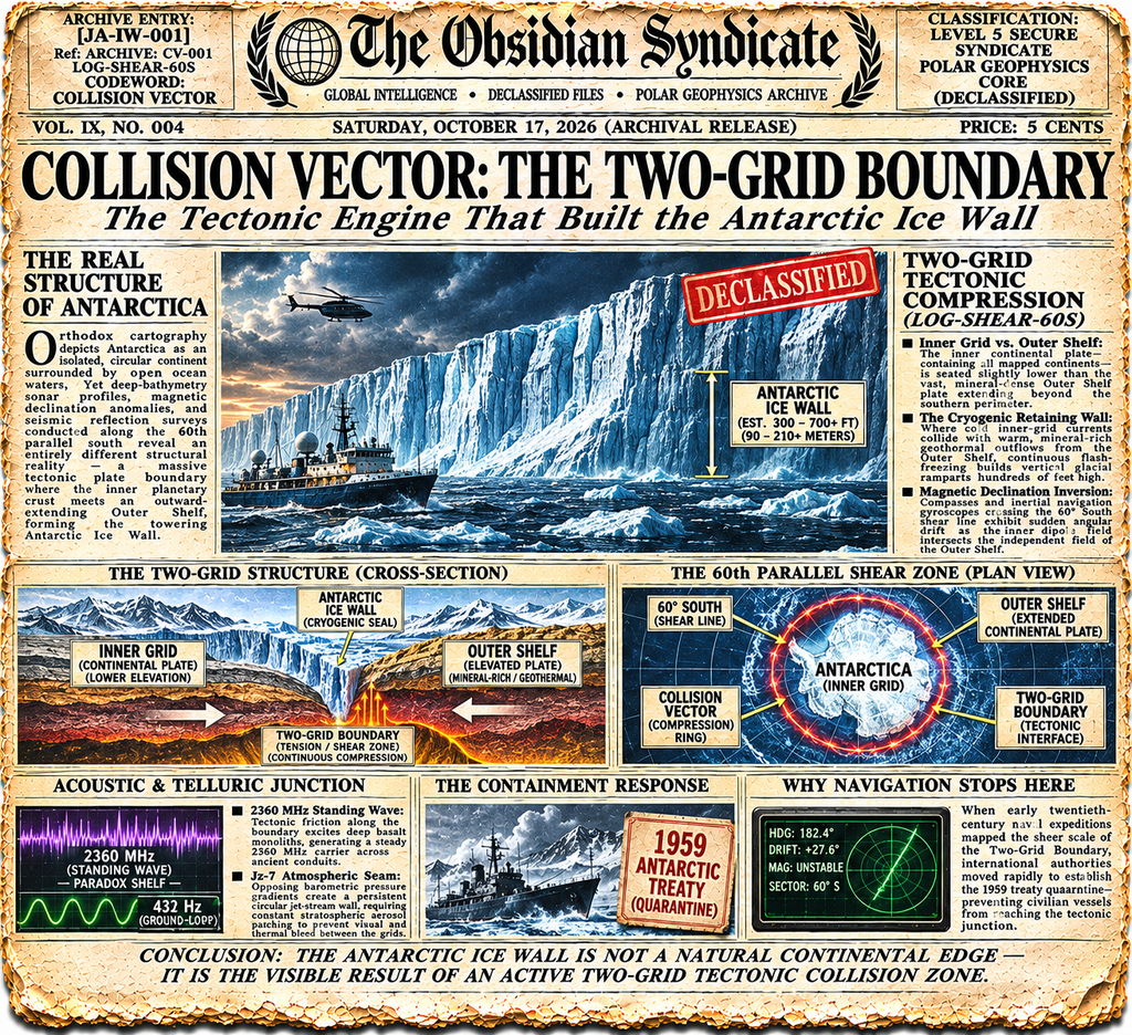
Orthodox cartography depicts Antarctica as an isolated, circular polar continent surrounded by open ocean waters. Yet deep-bathymetry sonar profiles, magnetic declination anomalies, and seismic reflection surveys conducted along the 60th parallel south reveal an entirely different structural reality. Rather than terminating at a conventional continental coastline, the inner planetary crust meets a massive, outward-extending tectonic plate along a high-tension circular fault zone. Declassified Syndicate geophysics records under codeword COLLISION VECTOR document the structural mechanics of this Two-Grid Boundary—explaining why the Antarctic Ice Wall forms a towering physical barrier around our known world.
Two-Grid Tectonic Compression (LOG-SHEAR-60S)
Seismic cross-sections taken across the Southern Ocean perimeter show two distinct crustal domains locked in continuous lateral and vertical compression:
- Inner Grid vs. Outer Shelf: The inner continental plate—containing all mapped continents—is seated slightly lower than the vast, mineral-dense Outer Shelf plate extending beyond the southern perimeter.
- The Cryogenic Retaining Wall: Where cold inner-grid ocean currents collide with warm, mineral-rich geothermal outflows seeping from the elevated Outer Shelf margin, continuous flash-freezing builds vertical glacial ramparts rising hundreds of feet above sea level.
- Magnetic Declination Inversion: Compasses and inertial navigation gyroscopes crossing the 60° South shear line exhibit sudden angular drift as the inner dipole field intersects the independent geomagnetic field of the Outer Shelf.
Acoustic & Telluric Junction Along the Boundary
Syndicate hydrophone telemetry confirms that the Collision Vector acts as the primary planetary waveguide anchoring the global telluric grid:
- 2360 MHz Standing Wave Generation: Continuous tectonic friction along the Two-Grid Boundary excites deep basalt monoliths embedded along the Paradox Shelf, generating the steady 2360 MHz carrier frequency measured across ancient inland conduits.
- Jz-7 Atmospheric Seam: Directly above the crustal fault line, opposing barometric pressure gradients form a persistent circular jet-stream wall—requiring constant stratospheric aerosol patching to prevent visual and thermal bleed between the two sectors.
Why Independent Navigation Stops at the Shear Zone
When early twentieth-century naval expeditions mapped the sheer scale of the Two-Grid Boundary, international authorities moved rapidly to establish the 1959 treaty quarantine—preventing civilian vessels from reaching the tectonic junction.
Cross-Referenced Dossiers in The Jalenza Archives
- [JA-IW-017] Aqua-Above: The 1957 Ross Sea Discovery & Why NACA Became NASA in 1958
- [JA-IW-014] Arctic-Contract: The 1959 Antarctic Treaty Secrets & First Contact Boundary Protocol
- [JA-IW-016] Twilight-Frequency: The 420nm Outer Shelf Light Matrix & Geothermal Climate Beyond Antarctica
- [JA-GM-009] The Basalt Antennas: Scalar Stone Towers, Piezoelectric Quartz & Sub-Crust Routing
Continue the investigation and discuss field telemetry inside The Jalenza Archives Facebook Group.
[JALENZA-DECLASSIFIED] [JALENZA-OFFICIAL] [JALENZA-ICE-WALL] [JALENZA-GLOBAL-MATRIX] [JALENZA-EXPEDITIONS] [JA-IW-001]
#JalenzaDeclassified #JalenzaOfficial #JalenzaIceWall #JalenzaGlobalMatrix #JalenzaExpeditions #JAIW001